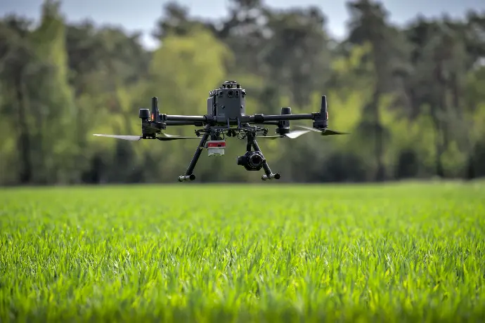
UAV sensing with the help of drones:
Om teeltproeven en gewassen vanuit de lucht te kunnen monitoren en data te verzamelen over de actuele gewasgroei op een perceel, kunnen verschillende soorten drones worden ingezet. Deze drones worden ook wel UAV-sensing (Unmanned Aerial Vehicle) genoemd.
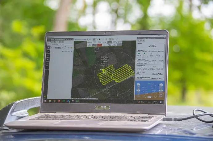
De VDBorne Campus bezit verschillende drones en camera's op deze drones. Deze camera’s kunnen verschillende elementen waarnemen, wat uiteindelijk verschillende data en beelden kan opleveren. Aan de hand van deze verzamelde data kan uiteindelijk een volledig beeld worden gegeven van het perceel, zodat vervolgens een taakkaart kan worden gemaakt voor een specifieke teeltmaatregel.
ASSETS
Nieuws en bijeenkomsten die je slimmer maken.
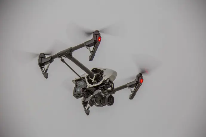
Cameras and capabilities:
- With the RGB camera, it is possible to recognize weeds on a field. Using this data, site-specific weeds can then be controlled. This can lead to savings in the use of crop protection products.
- A biomass or chlorophyll map can say something about the actual crop growth on a plot. This data can be obtained using a Multispectral camera attached to the MicaSense Altum. Using the data, a task map can be created, where variable fertilization or site-specific haulm kill in potatoes can then be applied.
- In addition, with the thermal camera, it is still possible to image the temperature of the crop. This camera is also attached to the MicaSense Altum.
For example, through variable fertilization and site-specific spraying, drones have shown that less environmental impact is possible. This is due to the fact that less crop protection and fertilizer can be used. It has been shown that the same yield can be achieved in the process.
Agri Drone Port Reusel
At the VDBorne Campus, crop monitoring is done with drones. To keep the quality of monitoring as high as possible, professional drones are used. These drones are often heavier and have better cameras. However, before professional drones are allowed to impact, measures, diplomas and permits are required. This is to ensure that operations are as safe as possible. On this basis, the RPAS airport, or Agri Drone Port Reusel put into operation. This is a closed airspace flying area. This flying area has three airport areas, each with a runway of three by three metres. An airport regulation is in force in this flying area, so the harbour master has to give permission before flying in the area. This makes the airspace safer and other air traffic knows, that drones can be affected in the airspace.
With the realization of Agri Drone Port Reusel, it is possible to establish trial fields, where professional drones can be used, to monitor the trial fields and the crops growing on them.
Remote sensing using satelites
To map a field from the air in order to monitor current crop growth, remote sensing can also be used. This is a technique used to observe crops at high altitudes with satellites. Here, the returning radiation from the earth's surface is measured with sensors located on the satellites. This allows crop growth to be imaged as plants absorb sunlight. The amount of reflected (sun) light/radiation measured says something about plant growth. The observed information is then transmitted to the base station. The measurement data from remote sensing, is less accurate though, than the measurement data from UAV sensing using drones.
ONZE CONTACTGEGEVENS
Postelsedijk 15
5541 NM Reusel
Nederland
E info@vdbornecampus.com
T +31 (0)497 641 878
VOLG ONS